Grand Paris Express metro
Client: Société des Grands Projets
Information system / Paris, France, 2016-today
I was appointed to program the wayfinding and signage system for several stations of the Grand Paris metro network in collaboration with AREP, a world-renowned French architecture firm. As the Paris metropolitan area experiences rapid growth, plans are underway to expand and develop the transportation system to meet the city’s evolving needs.
My role as a transportation information programmer involves analyzing metro station spaces on architectural blueprints based on passerby flow and determining optimal placement for navigation information.
> arep.fr
> societedesgrandsprojets.fr
> Some photos ©2024 Gérard Rollando (gerardrollando.fr)

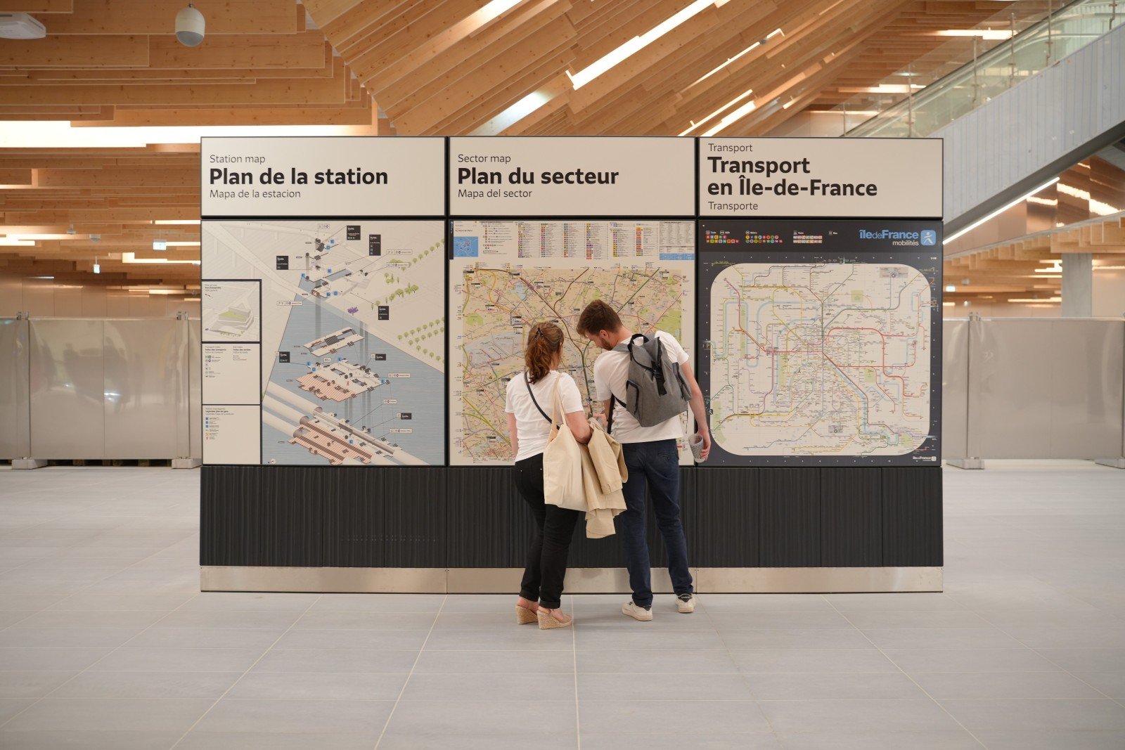
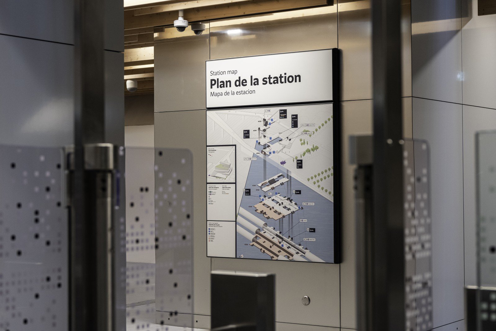
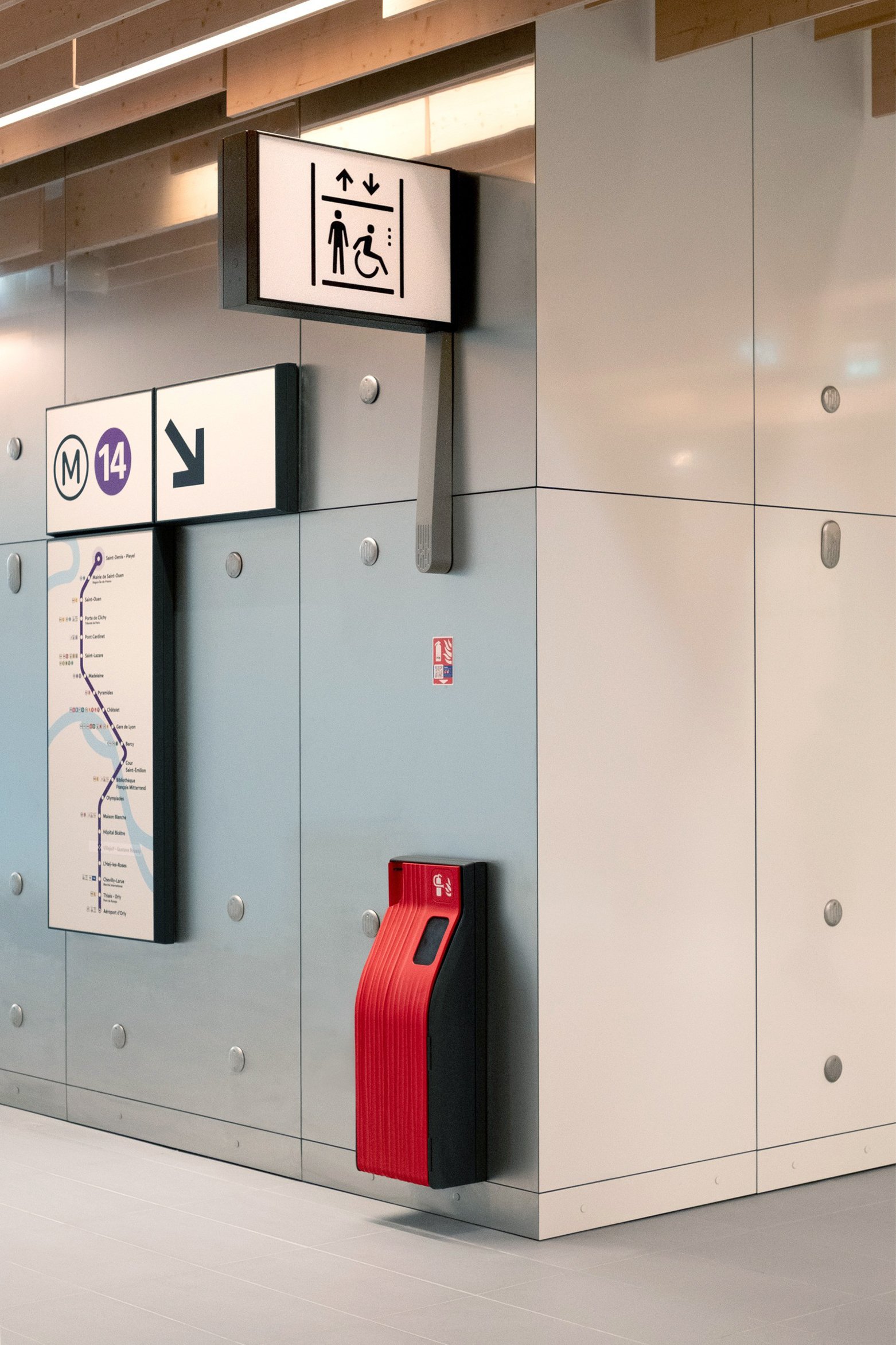
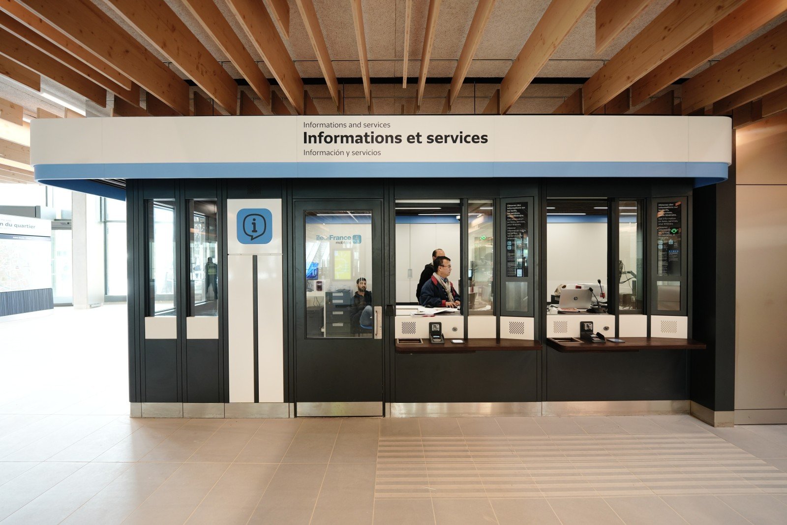
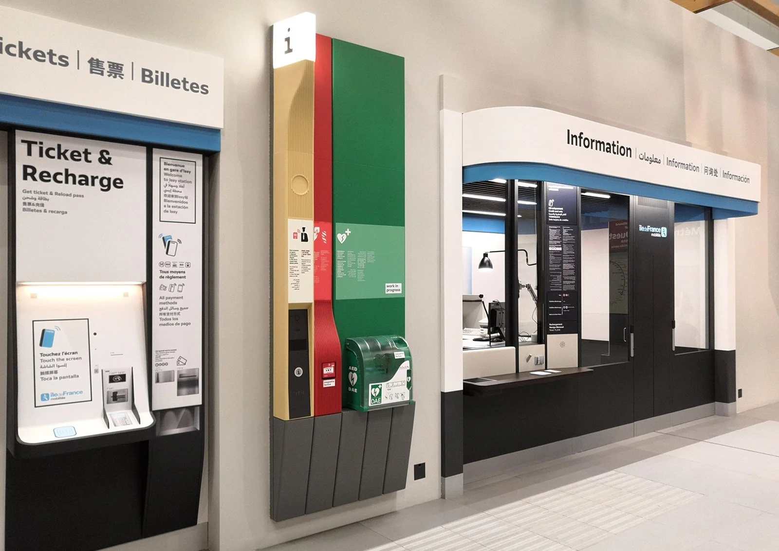
In public transport spaces, people move quickly. Directional and identification panels must be as legible and communication-efficient as possible, while taking into account visual impairments, language barriers, color blindness, and other accessibility-related factors.
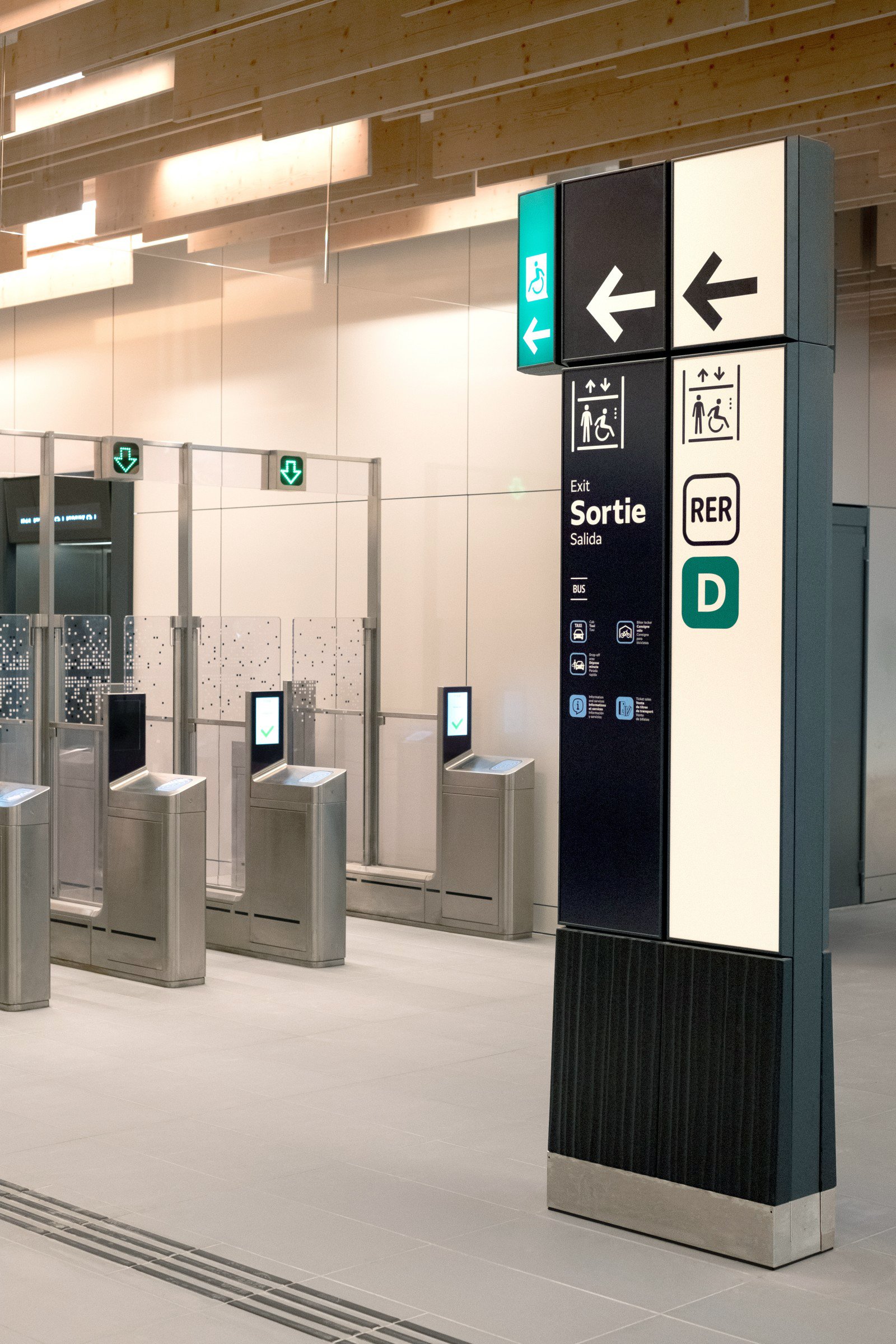
In the case of the Grand Paris metro network, a color-coding system was used to distinguish incoming-flow panels (light backgrounds) from outgoing-flow panels (dark backgrounds).

Fare control line, 3D rendering. Each area of the metro station requires specific types of information, whether territorial or network cartography, inbound and outbound directional signage, or emergency exit signage and safety equipment.

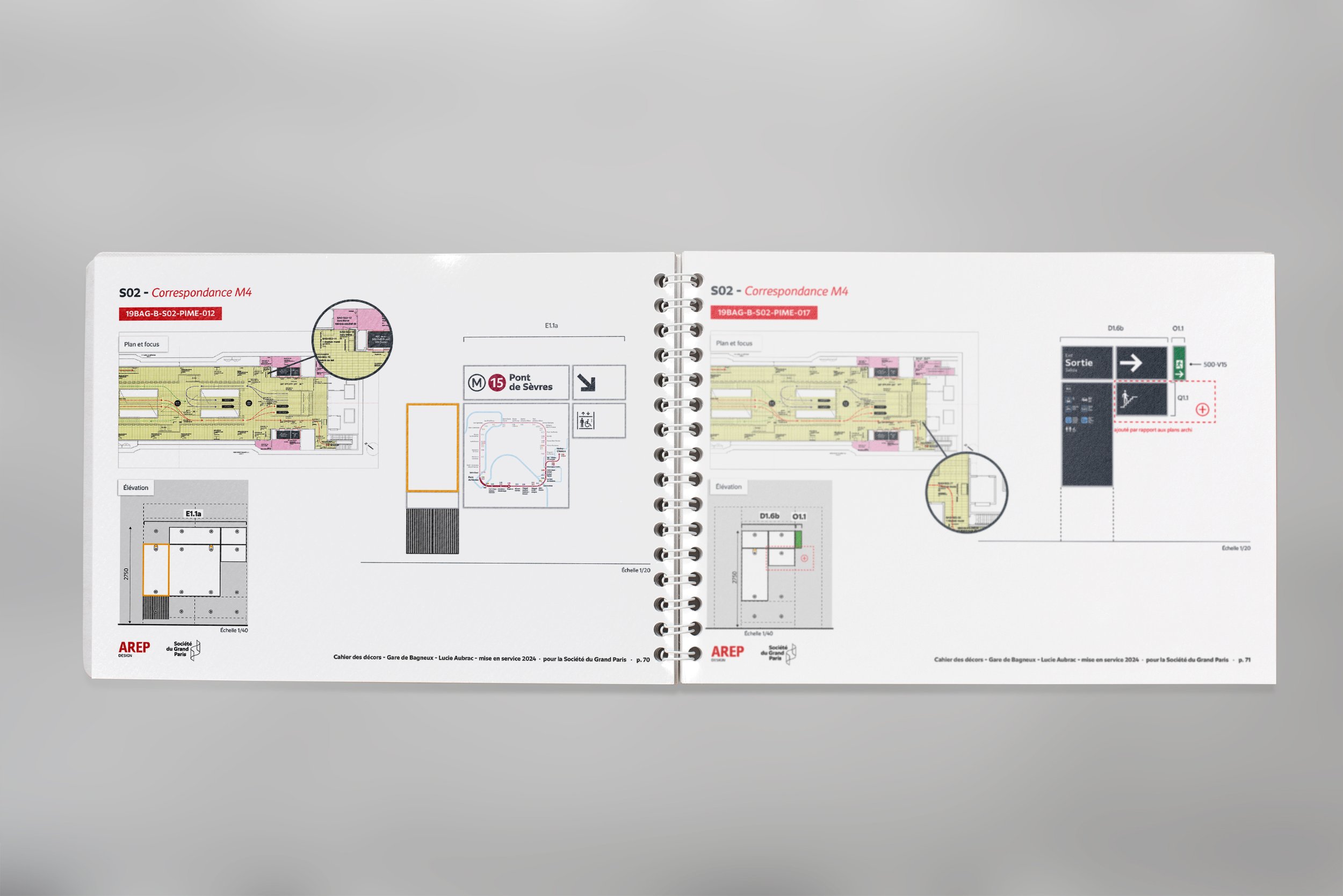
Signage Specifications Manual for Bagneux station.
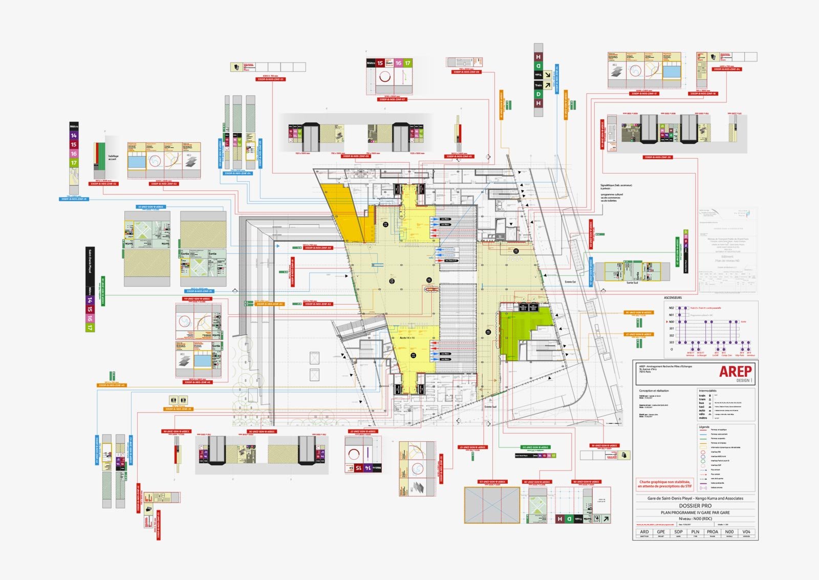
Synoptic plan for Saint-Denis - Pleyel station.

In some cases, directly within the platform waiting area, seating benches and station names were combined into totems, decorated with illustrations of local landmarks created by selected artists.